Tuesday, September 25, 2018

C-Astrals' Bramor Demonstration

     For a special treat, we had the honor of listening to a presentation of the CEO of C-Astral. He gave a very informative presentation of his experience leading up to C-Astral and the companies achievements. He talked mainly about what the platform at C-Astral can do. We were even able to see what was up and coming to the C-Astral fleet. The Bramor is a flying wing perfect for any consumer interested in flying commercially. Further down this report you will pictures of the Bramor. After the presentation we had the special opportunity to get to meet this aircraft. The test flight was to be done at Martell Forest. It was going to be a simple mapping mission, mainly to show the class the pre-flight check list and the professionalism behind larger commercial operations. The previous UAS classes had checklists, but for 3DR solos and simple slow sticks. Which contained a maximum of 10 steps or so. This bulky checklist had around 60 steps, quite a step up from the 3DR's.
     When we all first arrived we were watching Evan and Pete performing the pre-flight checklist. The ground control station (GCS) was already set up. We all watched as Evan and Pete carefully performed the pre-flight checklist. The checklist was more involved than previous ones we had done. The person reading the checklist off was to listen for a certain verbal cue to move on. Depending on what was checked off, the person physically checking would say check, clear, rubbers on, etc... for different actions. Since pictures speak a thousand words, the post will now show what we as a class got to experience.


Upon arriving at Martell, the first thing we saw was C-Astrals Bramor. Roughly 4 feet in wingspan and less than half of that front to back, the flying wing had a good size to it. Asking Marko (C-Astral CEO) about the airframe design and material, he said it was made of Kevlar and reinforced fiberglass. Looking into the airframe you could also see carbon fiber.


To the left, Dr. Hupy (far right with the boonie hat) and Pete (far left with the boonie hat) troubleshooting an issue with the Bramor. Still performing the pre-flight checklist. Looking closely, just aft of the midsection of the flying wing you can see a red box like figure. This is the parachute, the Bramors only method of landing (safely).


After performing all pre-flight checklist items, the Bramor was now ready to fly. The bungee assisted catapult launch was ready and sprung back. With the release of a button the Bramor would be launched into the air to begin its mapping mission.

This video is the Bramor as it is being launched, as you can see the catapult is very powerful. In less than a second it is accelerated from the catapult into flight. 


The Bramor has a very interesting method of landing. And that is a parachute. This method of recovery is used sometimes in applications but more rarely. The software used can roughly give users a good estimate of where the aircraft will land after parachute deployment to ensure the aircraft is not landing in hazardous or less than desirable terrain.


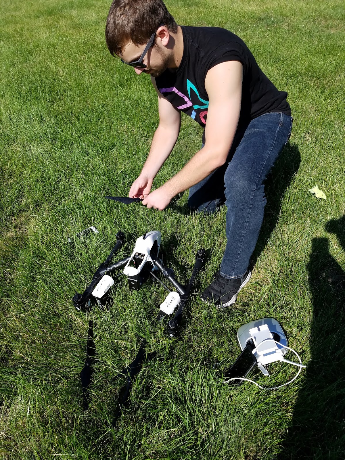
While we were there we were also able to watch a flight of the hexacopter there. While not C-Astral's airframe, it was still a very interesting airframe. One very cool sensor this airframe had was a thermal imagery sensor. There are no photos of this due to the environment causing to much reflection but seeing this sensor in action was very interesting. The hexacopter was flown to get thermal imagery of the field. Below are a few photos of it.
The hexacopter with the "cockpit" open


Hexacopter without the arms, preflight


GCS for the whole operation of both Bramor and hexacopter

Wednesday, September 19, 2018

Mapping at Dr. Hupy's House

     Since mapping is the one the most basic requirements for this class, our lab was to do some test flights with a DJI Inspire. In teams of two, our goal was to come up with a pre-flight and post-flight checklist for the Inspire. We also made a pre-flight checklist for the Red Edge camera.
     For the entirety of the three hours, we flew. My partner, Kyle Sheehan, was the first to fly. I was his visual observer (VO). Our mission was to fly from the end of Dr. Hupy's street to the soy bean field and take video of the entire journey. The entire mission took roughly 5-10 minutes and was more of an introduction to the DJI Inspire. To me, flying the Inspire was almost identical to flying the Mavic that I own. DJI has a the same user interface app for all of their commercial level drones. DJI has a very user friendly interface and design. The only different aspect to me, was the cost of each drone and the sensor package. Below are some photos that I took to document different stages of the flight. 
Above is Evan Hockridge and Krysta Rolle performing their pre-flight checklist for the first flight of the day. Dr. Hupy is helping out for the first couple of flights to ensure no mistakes are made unintentionally. 
Take off! The first flight of the semester, the DJI Inspire took off flawlessly. The weather for this day was perfect, low winds, sunny, and almost no clouds in the sky.
Pilot in Command/Technician Kyle Sheehan performing a pre-flight check on the DJI Inspire. He decided to fly first, then I flew second. Afterwards I became the Pilot in Command and technician. We both flew out missions without any mishaps. Our missions were identical, we both flew from the end of Dr. Hupy's road to a soy bean field. Taking video the entire way to eventually create a map out of the data.

Below is the checklist me and Kyle used for both of our flights.

Checklist 
DJI Inspire Checklist 
  • Ensure Pilot in Command is in good mental condition (sufficient sleep, more than 10 hours, and no mind-altering substances) 
  • Ensure battery percentage level ≥ 95% 
  • Ensure controller is charged ≥ 95% 
  • SD card inserted in and has sufficient space for data  
  • Ensure firmware is up to date and installed on aircraft  
  • Clean camera lens of any debris or obstruction 
  • Check image on viewing device for any obstructions or damage to camera, or blurriness 
  • Check airspace restrictions 
  • Check Wx 
  • Precipitation less than 5% 
  • Winds under 10 knots 
  • Ensure visibility is enough and legal 
  • Ensure flight is in between civil twilight hours (see local time for specific times) 
  • Ensure flight area is unobstructed and safe for flight  
  • Pre-flight check on air frame 
  1. Camera locked in place 
  1. Motors clear of FOD 
  1. Check propellers for damage 
  1. Ensure propellers are locked into place 
  • Ensure take off area is unobstructed 

Red Edge Checklist 
  • Ensure RedEdge has SD card inserted in 
  • Connect GPS module 
  • Connect power cable 
  • Power on the camera with the On/Off button. 
  • The LED will remain off while the camera turns on 
  • Ensure camera is connected through Wi-Fi 
  • Make sure status information is as follows 
  1. # of satellites used  
  1. Altitude is set to 0 AGL 
  1. Check the signal strength of each satellite 
Post Flight Checklist 
  • Power off aircraft 
  • Power off Red Edge 
  • Remove SD card from payload 
  • Connect SD card to computer to ensure quality images 
  • If image quality is good: continue 
  • If image quality is poor, adjust accordingly and fly again
  • Power on drone and reconnect to controller 
  • Put drone into travel mode by flipping landing gear switch up and down 5 times 
  • Power down drone 
  • Remove battery 
  • Power down transmitter 
  • Remove props and place in case 
  • Disconnect and remove Red Edge sensor and place it in its appropriate housing 
  • Put drone and transmitter in their case and lock 

x

Monday, September 10, 2018

Railroad UAS Consultation


There are over 76,000 railroad bridges spanning across the continental United States. These bridges cross over dangerous environments such as valleys, rivers, and large drop-offs. The current most accepted practice for inspecting bridges is to send a person down on a boom lift to inspect the underneath and sides of the bridge. However, this practice presents a great safety danger to the crew as equipment may defect and it oftentimes causes train delays/reroutes costing the company thousands of dollars. Using UAS for bridge inspections gets the person off the heavy machinery and on to solid ground where he/she can safely fly the aircraft capturing images at 20.8MP. Also, this allows trains to continue operations as the tracks do not get temporarily shut down.  
The DJI Inspire 2 was chosen for this use due to its gimbal ability. The Inspire 2, designed for cinematography, can perform railroad bridge inspections as well. The Inspire 2 has great GPS accuracy, 0.33 feet with downward vision system enabled, for taking perfectly still accurate shots.  Wind resisting flight of up to 10 m/s, helpful if there is a strong wind going under the bridge. With the long lasting 27-minute flight time, operators can maximize work done without the need of excess batteries or long charging sessions. The gimbal has a feature most of gimbals don’t and that is being able to pan upwards at a positive angle. The gimbal controllable range pitches from negative 130° to positive 40°, rolls from ±20°, and pans from ±320°
The camera to be used is a ZENMUSE 4XS, this camera is used for its high resolution at a lower cost. The camera is easily detachable from the platform, in case of malfunctions or incidents. The camera has a 1-inch sensor with 20.8 mega-pixels to capture clear photos of any damage to the structure. This camera has an estimated 27 minutes of battery life instead of its predecessor the X5S which has an estimated battery life of 24 minutes. The camera can take videos in 4K at 60 frames per second. The camera can also take burst photos at 14 frames per second and take photos during video capture. The gimbal has incredible stability giving you a precise ±0.01°. 
Bridge inspections require mobility and high detail imagery. This frame and camera are perfect for the job. The inspire 2 is able to precisely fly around the bridge and hover in place while correcting for wind gusts. The camera, capturing 20.8 megapixels allows the operator to capture imagery underneath the bridge while still flying away from the bridge to avoid interference or lost communication. With a +40◦ gimbal angle range, the DJI Inspire 2 is the perfect aircraft for capturing aerial imagery, as it can fly below bridge level and take pictures at a positive angle. 

In high-crime rate areas such as Chicago, train car break-ins and vandalism are common problems train police forces must tackle. Currently, they cover the yards by driving around in their cars and walking around the lines shining flashlights looking for trespassers. The three main considerations when formulating a platform are: maneuverability, long flight endurance, and IR capabilities as these trespassing's occur at night. The DJI Phantom 4 pro quadcopter has a 30-minute battery life. This coupled with its integrated collision avoidance and swift maneuverability led to the choice of aircraft. The integrated payload is replaced with a FLIR VuePro Camera to allow the operator to track heat signatures through the yards. 
The platform recommended for this mission is a Phantom 4 Pro. The Phantom 4 Pro has a wide variety of sensors available for use and can be equipped with various night vision/thermal sensors. The Phantom 4 Pro can fly for 30 minutes depending on payload. Its main camera shoots video in 4K at 60 frames per second. The camera can also take still photos with its 20-megapixel camera. Night time surveillance being the main use for this platform its camera would be useless but gives it versatility if needed to be used for daytime use. 
 The main use of this platform comes from its sensor, a FLIR VuePro. The FLIR VuePro is a thermal camera and data recorder. The VuePro’s spectral band is 7.5 - 13.5 µm with a zoomable function for closer views. Live feed video to main device lets user see real time footage.  Easy to use phone app lets users select which color option they want to see their imaging in. Camera frame rate at 30 Hz for NTSC and 25 Hz for PAL. Sensor resolution is 640x512 giving the viewer a crisp thermal image. Putting together the sensor and airframe would give users a great platform to have an eye in the sky against potential criminals.  
Night operations present a challenge for UAV operators, as they are unable to see any visual from the aircraft in flight. Equipping a thermal camera to the aircraft allows the operator to track heat signatures and gather a better understanding for the environment around them. By using a UAV, the police forces can cover an increased range, tagging specific vandal’s locations so that other officers may mobilize to the site and make the necessary arrests. The platform mentioned above is perfect for the operation. Its ability to maneuver easily and stay in the air for extended periods of time allow the police forces to work in high pressure areas with confidence.  

Beyond visual line of site unmanned flight is becoming more accepted by the FAA. Although an exemption is required to fly past line of sight, the practice is very helpful for efficiently capturing data in certain fields. One of these fields is the rail industry, where thousands of miles require inspections. Historically there are different train cars strapped with cameras and sensors that ride along the tracks. However, with increased UAV technologies, overhead flights for rail inspection increases safety by getting people off the tracks. 
Since this application demands a lot, the package isn't cheap. Roughly estimating 150,000 dollars the Latitude Aerosonde HQ offers a great deal of reliability. The Aerosonde is a VTOL UAS that can take off like a helicopter, fly like an airplane, then land like a helicopter. This is can be particularly useful for places where runway space is very limited. This is also useful because it eliminates the need for large systems to launch or recover the aircraft. Powered by a powerful, reliable Piccolo flight controller, the Aerosonde can fly for up to 14 hours. With this long duration, the Aerosonde has a range of 75 nautical miles. Giving users a long duration to capture data or perform missions. The Aerosonde can also carry up to 20 pounds also giving users the ability to use a wide range of sensors.  
The camera chosen for this platform and mission is a TASE 400. This camera is a day and night camera. The camera is stabilized on 2 axis and is integrated with GPS. If users need to have data processed as soon as possible this camera also has onboard video processing. The TASE 400 is also environmentally sealed so that flying in rain or misty conditions won’t affect the camera. Weighing only 8 pounds it is well below the payload limit for the Aerosonde. 360-degree motion and live feed will give the operator live feed of anything that is around the Aerosonde While prices for these are not advertised, consumers can expect to pay a hefty amount. 
Getting cars off the tracks also increases rail efficiency. Just like in the bridge inspections, by getting cars off the track they locomotives can continue typical operations without slowing down or rerouting. Using a fixed wing aircraft is necessary because of its long flight capability. Also, the aircraft must have vertical takeoff and landing (VTOL) capabilities because of the tight spaces along some parts of the rail lines where other launch and recovery tactics are not plausible.